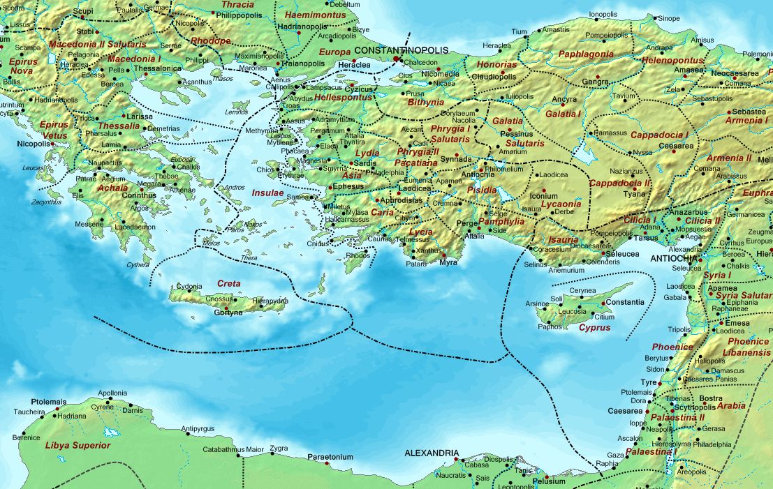
Paul's Travel Map
The black dots and dashes show the borders around the empire's dioceses (government areas)
- Macedonia containing Macedonia 1 & 2, Thessalia, Epirus Nova and Vetus, Achaia and Creta
- Thrace containing Europa, Haemimontus, Thracia and Rhodope. Also (off the map) Moesia and Scythia
- Asia containing Asia, Hellespontus, Pamphylia, Caria, Lydia, Lycia, Lycaonia, Pisidia, Phrygia 1 & 2, and the adjoining Aegean islands in the aptly named province Insulae.
- Pontus containing Bithynia, Galatia 1 & Galatia Salutaris, Paphlagonia, Honorias, Cappadocia 1 & 2, Helenopontus, Pontus, and Armenia 1 & 2.
- Oriens (The East) containing Palestina 1 & 2, Arabia which then included the Sinai Desert as Palestina 3, Phoenice and Phoenice Libanensis, Syria 1 & 2, Cilicia 1 & 2, Isauria, the close island of Cyprus, also (off the map) Euphratensis, Osroene, Mesopotamia, Corduene
- Aegyptus (Egypt) containing Egypt (four different provinces) and Libya (two provinces)


